Essential Skills for Effective Map Reading and Navigation Techniques
- DAGBO CORP
- Mar 25
- 3 min read

Navigating unfamiliar terrain can be challenging without the right skills. Even with modern GPS technology, understanding how to read a map remains a crucial ability for outdoor enthusiasts, travelers, and professionals alike. Mastering map reading not only improves your confidence but also ensures safety and efficiency when exploring new areas. This post breaks down essential skills and practical navigation techniques to help you become a proficient map reader.
Understanding Map Basics
Before diving into navigation, it’s important to grasp the fundamental elements of a map:
Scale
The scale tells you the relationship between distances on the map and actual distances on the ground. For example, a 1:50,000 scale means 1 unit on the map equals 50,000 units in reality. Knowing this helps estimate travel time and distance.
Legend
The legend explains the symbols and colors used on the map. Common symbols include trails, water bodies, elevation changes, and man-made structures. Familiarize yourself with these to interpret the map correctly.
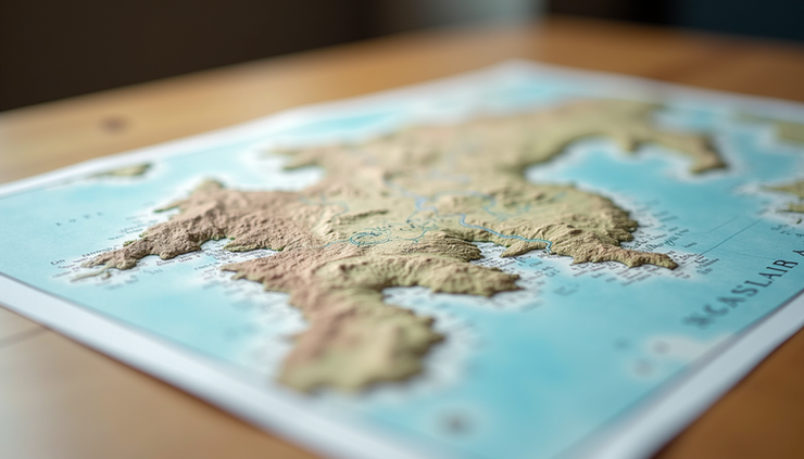
Contour Lines
These lines represent elevation and terrain shape. Close contour lines indicate steep slopes, while wider spacing suggests gentle terrain. Understanding contour lines helps you anticipate the difficulty of your route.
Compass Rose
This shows the cardinal directions (North, South, East, West) and magnetic declination. Aligning your map with the compass ensures accurate navigation.
Essential Map Reading Skills
Orienting the Map
Start by aligning your map with the real world. Use a compass to find magnetic north, then rotate the map until its north matches the compass. This step makes it easier to relate map features to your surroundings.
Identifying Landmarks
Look for distinct features like rivers, peaks, roads, or buildings on the map and locate them in your environment. Recognizing these landmarks helps confirm your position and guides your path.
Using Grid References
Most maps use a grid system with numbers or letters along the edges. Learning to read grid references allows you to pinpoint exact locations. For example, a six-figure grid reference can identify a spot within 100 meters.
Measuring Distance
Use the map scale and a ruler or piece of string to measure distances between points. This helps plan how far you need to travel and estimate the time required.
Navigation Techniques
Dead Reckoning
This technique involves moving from a known point using a compass bearing and estimated distance. For example, if you know your starting location and the direction and distance to your destination, you can navigate without visible landmarks.
Triangulation
Triangulation helps determine your exact position by taking bearings to at least two known landmarks. By drawing lines on the map from these landmarks at the measured angles, your location is where the lines intersect.
Following Contour Lines
When hiking, following contour lines can help maintain a steady elevation and avoid unnecessary climbs or descents. This technique is useful for conserving energy on long treks.
Using Handrails and Catching Features
Handrails are linear features like rivers, roads, or ridges that guide your route. Catching features are landmarks that signal when to stop or change direction, such as a bridge or clearing. Using these features simplifies navigation and reduces errors.
Practical Tips for Effective Map Reading
Practice regularly with different types of maps to build confidence.
Carry a reliable compass and know how to use it alongside your map.
Check magnetic declination for your area to adjust compass readings.
Plan your route before setting out, noting key landmarks and distances.
Keep track of your progress by identifying landmarks as you move.
Stay aware of weather conditions that may affect visibility or terrain.


Comments